Introduction to Mt. Rinjani: Indonesia’s Second Highest Volcano
Nestled on the Indonesian island of Lombok, Mt. Rinjani stands as a majestic testament to the island’s geological and cultural richness. As the second highest volcano in Indonesia, with an elevation of 3,726 meters (12,224 feet), Rinjani draws thousands of adventurers, nature lovers, and cultural explorers each year. Its imposing silhouette dominates the landscape, offering a challenging yet profoundly rewarding experience for hikers and trekkers. This comprehensive guide explores the multifaceted aspects of Rinjani—from its geographical and volcanic significance to trekking routes, ecological treasures, and sustainable tourism practices—enabling a complete understanding for enthusiasts planning their exploration.
Geographical Location and Significance
Gunung Rinjani is situated within the boundaries of the Rinjani National Park in North Lombok, West Nusa Tenggara, Indonesia. This active stratovolcano spans approximately 41,330 hectares (around 102,100 acres), making it one of the most prominent features on the island of Lombok. Its strategic location within a major transition zone between Wallacea and Australasia creates a unique ecological interface, supporting diverse flora and fauna endemic to the region.
Rinjani’s prominence is not just geographic—its volcanic activity has shaped the island’s history, landscape, and local cultures. The mountain serves as a natural barrier influencing weather patterns, contributing to Lombok’s distinct microclimates. Its towering presence has held spiritual significance for local communities for centuries, marking it as a sacred site intertwined with ancestral beliefs.
From a geological perspective, Rinjani is a dynamic volcano, with its caldera hosting a large crater lake called Segara Anak. The volcano’s influence extends beyond geological formations—its eruptions have historically impacted regional climate and ecology, with notable eruptions recorded in the past, including significant activity in 2015.
Historical Eruptions and Volcanic Activity
Mount Rinjani’s volcanic history reflects periods of intense activity intertwined with quieter phases. Its first known eruptions date back several thousand years, with archaeological evidence indicating early human interactions with volcanic ash deposits.
One of the most influential recent eruptions occurred in 2015, characterized by ash plumes reaching altitudes of 6 km and lava flows that temporarily disrupted access and safety protocols. This eruption underscored Rinjani’s status as an active volcano and highlighted the importance of continuous monitoring and preparedness.
The Indonesian volcanological authorities closely monitor Rinjani’s activity, providing updates and warnings to ensure the safety of visitors and nearby communities. The volcano’s eruptive cycle is classified as vulcanian, with ash emissions, geothermal activity, and occasional lava flows. Understanding its past and ongoing activity helps inform risk management and preparedness strategies, which are vital for the thousands who venture on trekking expeditions each year.
Conservation and National Park Status
Recognized for its ecological and cultural value, Mount Rinjani is protected within the Rinjani National Park, established to preserve the area’s biodiversity, geological features, and cultural sites. As a protected area, the park covers over 41,000 hectares and is managed by the Indonesian Ministry of Environment and Forestry, with active involvement from local communities.
Conservation efforts focus on safeguarding endemic species such as the Rinjani scops owl, various primates, and a rich tapestry of plant life—including numerous orchids, medicinal herbs, and hardwood species. The park’s management also emphasizes sustainable tourism to minimize environmental impact, promote ecological education, and support local livelihoods.
Visitors are encouraged to follow strict guidelines, including waste management, staying on designated trails, and participating in eco-friendly activities. The park’s status not only protects the natural environment but also ensures that future generations can continue experiencing the mountain’s awe-inspiring landscapes and ecological riches.
Planning Your Trekkings to Mt. Rinjani
Best Seasons and Weather Conditions
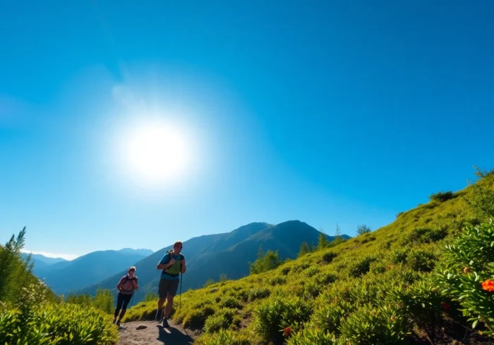
The optimal period for trekking Mount Rinjani is during the dry season, typically from April to October. During these months, weather conditions are more stable, with less rainfall and clearer skies, which are essential for safety and visibility. The peak trekking months are July and August, attracting the majority of international and domestic hikers.
The wet season, from November to March, brings heavy rains, mudslides, and unstable volcanic activity, making treks more hazardous. Cold temperatures near the summit—often dropping below freezing—necessitate proper clothing and gear.
Permits, Guides, and Safety Precautions
Prior to embarking on your journey, securing the necessary permits is crucial. Trekking permits are issued by the Rinjani National Park authority and are often included in guided tour packages. It is highly recommended to engage certified guides, who are familiar with the trails, safety procedures, and emergency protocols.
Safety should be a priority: trekkers must be aware of altitude sickness, sudden weather changes, volcanic activity alerts, and proper emergency procedures. Always check recent park advisories before your trek and consider joining a guided group for added support.
Essential Gear and Preparation Tips
Proper preparation involves packing appropriate equipment tailored to Rinjani’s conditions:
- Warm, windproof clothing for the summit
- Hiking boots with ankle support
- Sleeping bags suitable for cold temperatures
- Headlamps and extra batteries
- Daypack with sufficient water, snacks, and first aid kit
- Rain gear and waterproof clothing
- Sun protection: hats, sunglasses, sunscreen
Additionally, physical fitness and acclimatization are critical. Regular cardio training and gradual altitude exposure help prevent altitude sickness. Hydration and nutrition during the trek significantly impact performance and safety.
Routes and Trekking Options for Mt. Rinjani
Sembalun vs. Suta Routes: Pros and Cons
Two primary routes lead to the summit: the Sembalun Route and the Senaru Route. Each offers unique characteristics suited to different trekkers:
- Sembalun Route: Known for its relatively gentle ascent and stunning panoramic views, this route originates from Sembalun Lawang village. It covers approximately 27 km and involves traversing lava fields and grassy slopes. Its slower ascent allows better acclimatization, making it popular among beginners and those seeking scenic beauty.
- Senaru Route: Starting from Senaru village, this route is more challenging with steeper inclines and dense forested areas. It’s approximately the same length but involves more technical sections. Suitable for more experienced trekkers, this path offers a lush rainforest environment and access to waterfalls.
Duration, Difficulty, and Key Landmarks
Typical trekking durations range from 2 to 4 days, depending on the chosen route and pace. The standard three-day trek is most popular, allowing for proper acclimatization and exploration.
Key landmarks include:
- Segara Anak crater lake
- Hot springs near the crater
- Lava fields and volcanic craters
- Summit at 3,726 meters
The most strenuous parts involve ascending from the crater floor to the summit, often requiring hands-on scrambling and cautious navigation.
Guided Tours and Independent Climbing
While guided treks are strongly recommended for safety, many adventure companies offer customizable packages, including permits, guides, porters, and accommodations. Independent climbing is possible but involves complex logistics, rigorous planning, and thorough knowledge of the trails and risk factors. Novices should opt for guided tours to ensure safety and a richer cultural experience.
Experiencing the Unique Environment of Mt. Rinjani
Flora, Fauna, and Ecological Significance
Rinjani’s ecological diversity is a key highlight. Its varied altitudes support distinct ecosystems:
– Lowland rainforest with rich biodiversity including tropical hardwoods, orchids, and medicinal plants.
– Montane forests hosting unique bird species, primates, and endemic insects.
– Alpine zones near the summit with sparse vegetation adapted to cold and wind.
The park serves as a vital habitat for endangered species such as the Rinjani scops owl, the crested serpent eagle, and various species of langurs. Conservation efforts focus on maintaining these habitats amidst increasing tourism and climate change effects.
Hot Springs, Waterfalls, and Scenic Spots
Surrounded by lush forests and volcanic activity, Rinjani offers several natural attractions:
- Segara Anak Hot Springs: Located near the crater, these geothermal springs are soothing and popular after long hikes.
- waterfalls: Notable waterfalls near Senaru such as Sindang Gila and Tiu Kelep provide refreshing excursions and photoshoots.
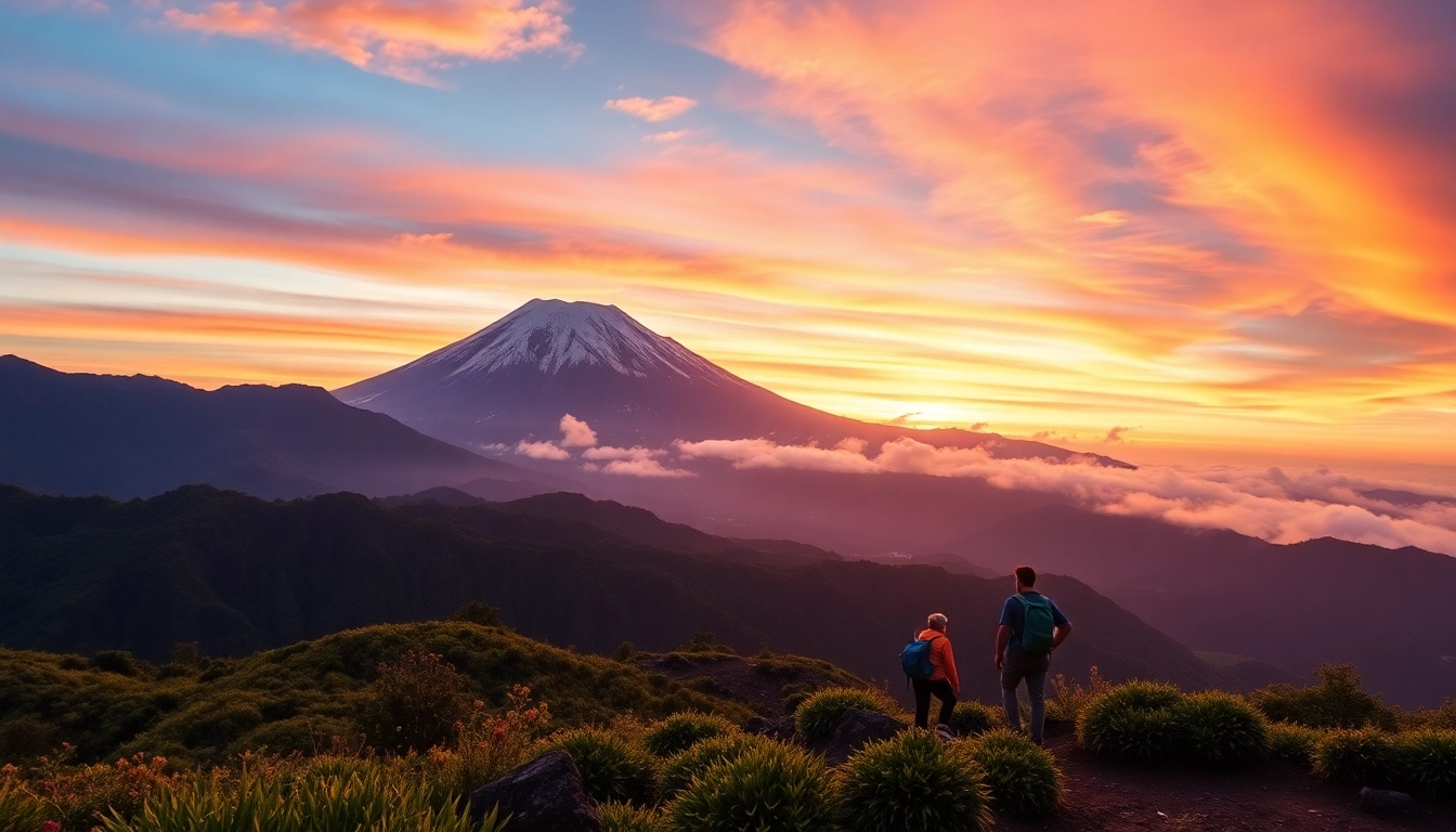
- Scenic viewpoints: Peaks such as the Sukarara viewpoint offer sweeping vistas of the surrounding islands and sea.
Cultural Heritage and Local Communities
Rinjani’s cultural tapestry is as vibrant as its landscape. Local Sasak, Bugis, and Balinese communities have legends linked to the volcano, often viewing it as a sacred ancestor. Traditional ceremonies, offerings, and rituals are still practiced, especially during specific festivals or eruptions.
Participating respectfully in local culture enhances the trekking experience and fosters community-based tourism. Engaging with local guides, staying in community lodges, and supporting cultural initiatives contribute to sustainable tourism growth.
Post-Trek Highlights and Conservation Efforts
Maintaining Sustainability and Responsible Tourism
As Rinjani continues to attract adventure seekers, sustainability becomes increasingly critical. Visitors are encouraged to adhere to Leave No Trace principles, limit single-use plastics, and respect wildlife and cultural sites. The park authorities have implemented trail restrictions, waste management systems, and educational programs to minimize environmental impact.
Promoting eco-friendly transportation options and encouraging local employment in guiding and hospitality sectors further supports responsible tourism. Visitors can also participate in reforestation projects or community cleanup drives initiated by park and local NGOs.
Supporting Local Economies and Communities
Tourism revenue plays a vital role in supporting local livelihoods. From guiding services, homestays, crafts, to local markets, the community benefits directly from responsible tourism practices. Visitors can contribute by purchasing local products, choosing community-based accommodations, and engaging in cultural exchanges.
Tips for Future Climbers and Ongoing Safety Updates
Continual safety and environmental updates should inform every trekker’s planning process. Monitoring volcanic activity reports, weather conditions, and park advisories is essential. Travelers should register with park authorities, hire experienced guides, and prepare for emergencies with comprehensive planning.
Ultimately, preserving the natural integrity and cultural heritage of Rinjani ensures that future generations can experience its raw beauty and spiritual significance.